|
File No.:
Case File # 19
Title: "The Lost Aerial
Photos of Arnhem"
Subject:
Allied Aerial
reconnaissance photographs
showing Nazi armored units in
the Arnhem area prior to
Operation "Market Garden".
Investigation made at:
Deelerwoud Forest, municipality
of Ede and Wageningen
University, Province of
Gelderland, The Netherlands.
GPS Location:
52°04'45.4"N 5°53'54.3"E
Period Covered:
12SEP1944-22FEB1945
Date: 27NOV2018
Case Classification:
Imagery Intelligence (IMINT /
PHOTINT), Aerial photography
analysis and
interpretation, Evidence
provided for error in Royal Air
Force Air Historic Branch publication.
Status of Case: Unsolved
|
Introduction:
The 1977 Hollywood
production A Bridge Too Far
features the remarkable story of
a British Intelligence officer
in the Airborne Corps (named
Brian Urquhart in reality but
called “Major Fuller” in the
film to avoid confusion with
Airborne General Roy Urquhart
played by actor Sean Connery),
who requests a last minute photo
reconnaissance sortie and gets
the approval for it. The result
of the Major’s determination
however, an oblique photo
showing German tanks and
halftracks concealed in a
countryside tree line, is not
appreciated by his superior,
General Frederick “Boy”
Browning, commanding the 1st
Allied Airborne Army.
The photo shown in the film
(which is clearly fabricated for
the production of A Bridge Too
Far as it shows the photo which
the pilot in a previous scene
about the photo reconnaissance
sortie took) has intrigued this
agency for decades and raised
the desire to learn more about
it. |
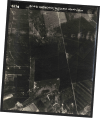
(click to enlarge)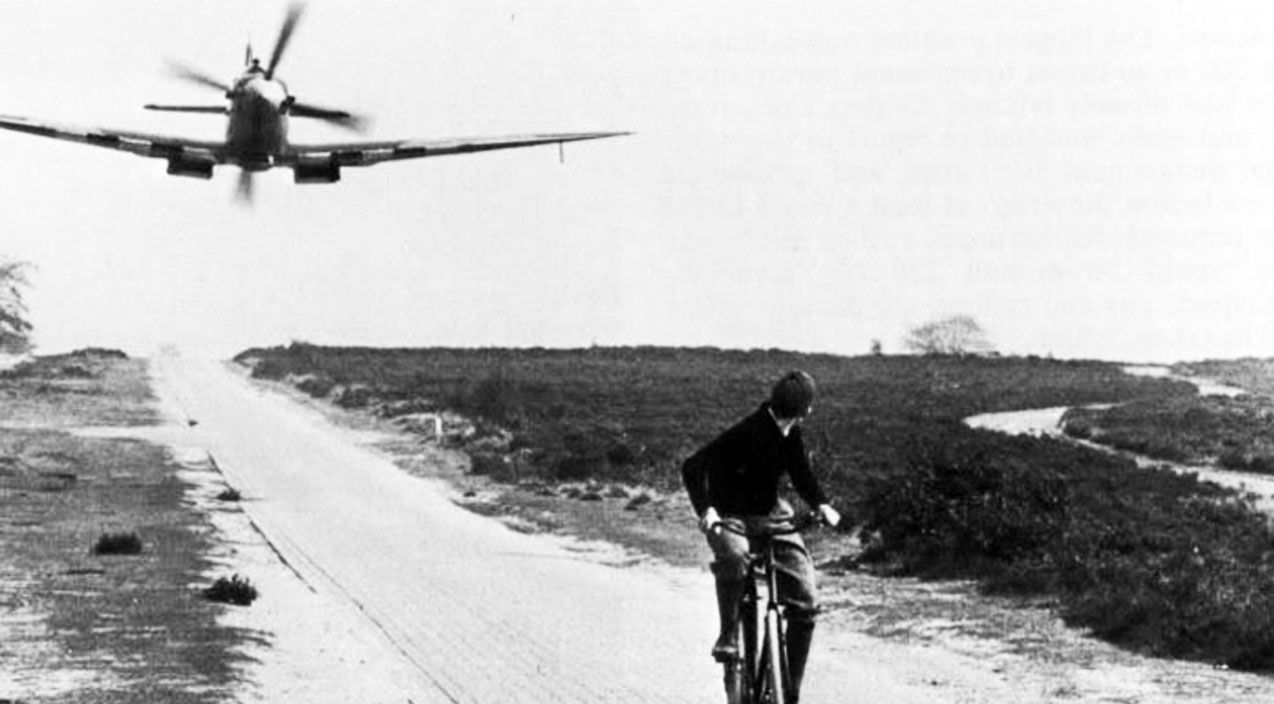
The Hollywood
aerial photograph |
|
REASON FOR INVESTIGATION:
MAJ Brian
Urquhart explained what led him
to order the aerial photo
mission:
"The really telling fact that
there were two SS Panzer
divisions rearming literally
almost on the dropping zone, I
mean they were within a mile or
two. We first got that in the
Order of Battle reports from 21
Army Group. I just happened to
notice it in one of these
intelligence summaries that used
to come down every day. Then we
had very good Dutch Resistance
liaison officers with us, and I
asked them if they could find
out, and they said: ’Yes,
indeed, yes, absolutely. We can
tell you which divisions they
are. Of course they’re there.’ I
somehow couldn’t get anybody to
focus on this. And I got one of
the Spitfire squadrons, which
was stationed in Benson, just
outside Oxford, to go along on
one of the fighter sweeps and
take oblique photographs of this
particular area. And sure
enough, there the German
vehicles were, mostly in
camouflage, but they were
unmistakable."
- Page 109 of “Great military
blunders”, Geoffrey Regan, 2000,
Channel 4 Books, ISBN 0752218441
-
Several documentaries have shared
our interest in photo intelligence
indicating enemy armored
concentrations in the area of
operations of "Market Garden".
For example: "Battlefield
Detectives"; a forensic documentary
television series that aired on the
History Channel from 2003 to 2006.
In Season 2 "World War II: Operation
Market Garden" of 12NOV2004 we hear
Peter Caddick-Adams of the Royal
Military College of Science in the
United Kingdom say "In the week
prior to the Arnhem operation being
launched on the 17th of September,
there is a suggestion that
German armour is spotted by aerial
photography in the Arnhem area".
The narrator continues: "But no
one since has seen these
photographs. Peter believes that if
they can be found, and German tanks
can clearly be seen, it would be
compelling evidence that Operation
"Market Garden" was flawed from the
outset. The search leads him
to the archives at Keele University.
But it's frustrating. Although a
staggering eight million images
survive from the Second World War,
at the end of the conflict, the
cataloguing system was simply thrown
away. Finding images of a particular
operation or place is like looking
for a needle in a haystack." The
documentary then shows an
example of an areal photo of Arnhem
bridge taken prior to the operation
and showing traffic followed by
Caddick-Adams talking about details
such as tanks and trenches which can
be seen in such photographs.
Narrator: "It's these traces of
German activity that Peter is
searching for in the images from
Arnhem. [...] But it's the
missing images from Arnhem that
Peter really needs."
In answer to the question of Caddick-Adams
if he has found the equivalent for
Arnhem, the projector operator in
the Keele Archives says:
"Unfortunately in the material that
we've so far catalogued we have not
found anything. it's not to say that
we don't have anything but maybe in
years to come we will find the
photograph that you're after. "
|
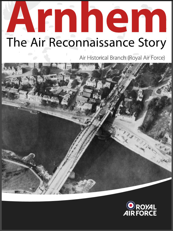
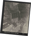
New Evidence
But in 2015 it seemed that Dr.
Sebastian Ritchie of the Royal Air
Force's Historical Branch had at
last found the
"pičce de résistance"
of
Allied intelligence for Operation
"Market Garden".
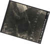
In "Arnhem, The Air Reconnaissance
Story", (Crown Copyright MOD 2016,
published (online)
by the RAF's Air
Historical Branch)
the following photo is presented
with the accompanying contemporary
analysis and interpretation
diagrams: |
 |
|
(click to enlarge)
 |
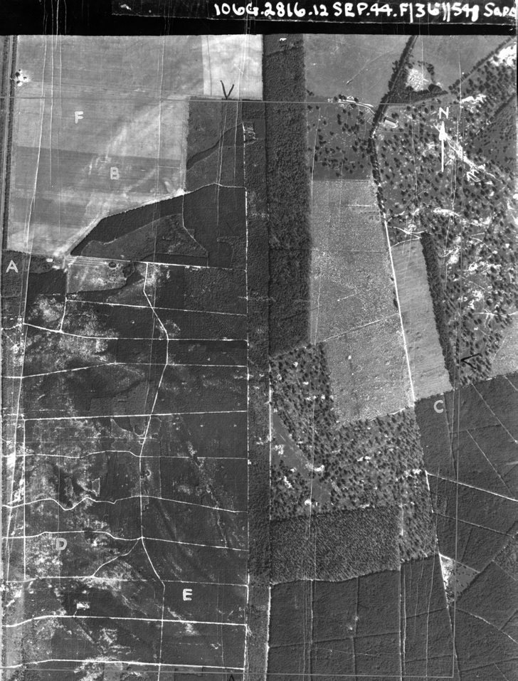
On pages 15 & 17 of the RAF AHB
study we read:
"The Spitfire routed east, north
of Arnhem and across the main
Arnhem-Apeldoorn road, before
banking and commencing a westward
run just south of the village of
Loenen, orientated slightly north of
the Luftwaffe airfield at Deelen.
Seconds later, Fuge was flying over
woodland known as the Deelerwoud,
northeast of the airfield.
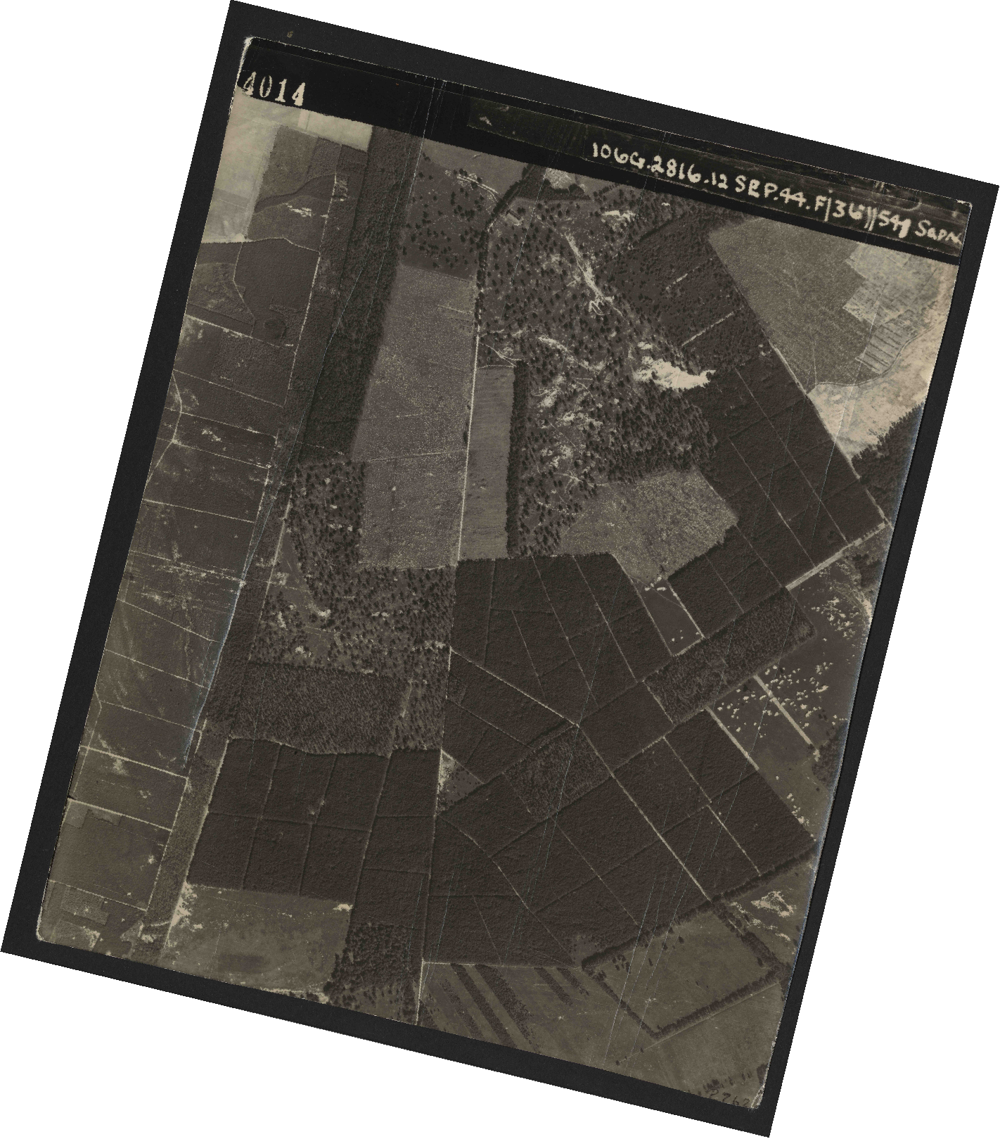
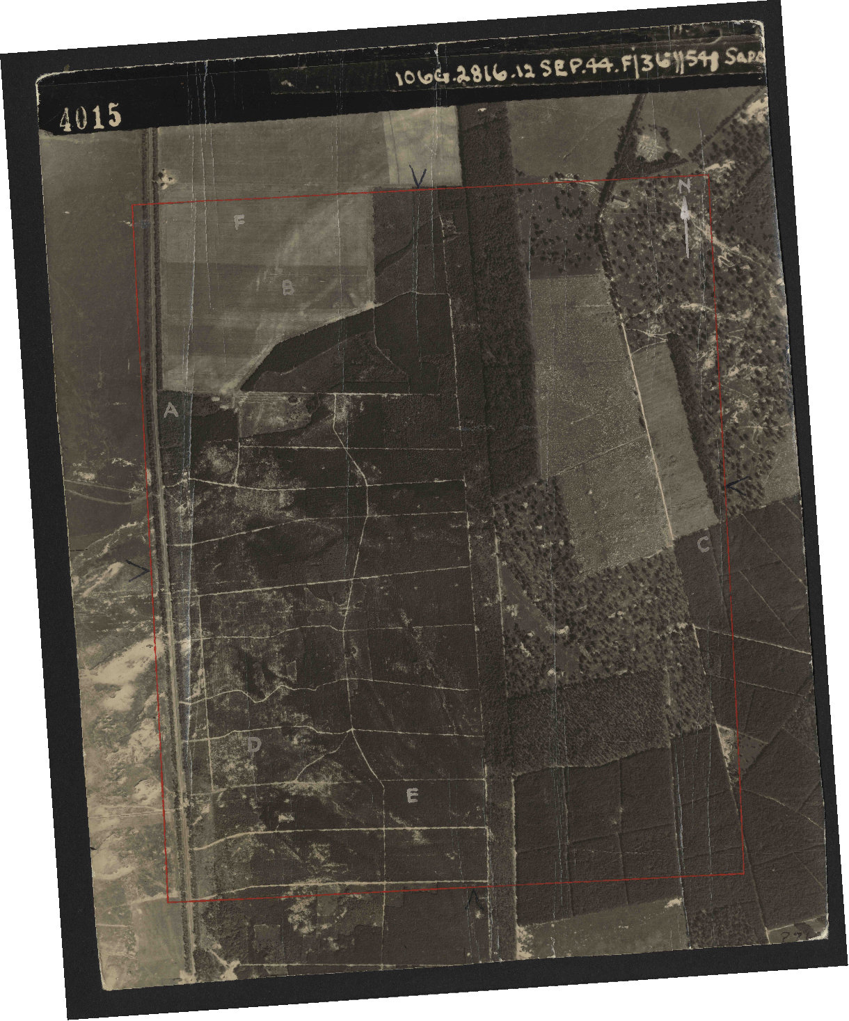
His first frame was numbered 4001;
[footnote 67] frame 4015, his
fifteenth (out of a mission total of
942 frames) differed from every
other in so far as it contained
visible markings and lettering,
indicating that it was the subject
of a detailed report or briefing.
Yet, while the area concerned was
immediately next to a very large
military target, the lettering
clearly did not relate to the
airbase in any way, shape or form.
Sadly, the report that accompanied
frame 4015 could not be traced, but
a high-resolution download of the
photograph ultimately explained
lettering, albeit via enlargement
and some digital enhancement.
The interpreter’s task was probably
to check each area of the image for
indications of enemy activity. In
Areas A, B, D, E and F, he had only
to confirm its absence: there was
nothing to report.
The contrast with Area C could
hardly have been more pronounced.
Here, multiple German armoured
fighting vehicles (AFVs) and other
vehicles can be observed near the
intersection of two woodland tracks,
apparently halted while moving
south. Some are partly obscured by
tree cover, while others
are in the open; camouflage measures
are not in evidence. While there is
insufficient resolution and too much
cover from trees or shadow to
provide more than a few reliable
identifications, the larger tanks
include Panzer IVs of
early design, with short-barrelled
75mm guns; there are also smaller
tanks, including Panzer IIIs, which
are, again, early models equipped
with 37mm guns. Some of the tanks
have rotated turrets, probably to
create space for maintenance work or
fuelling – a routine procedure."
Footnote 67 reads as follows: 67.
https://originals.dotkadata.com/?language=en#!
1&bron=BWUR_WOII_RAF_USAAF&sortienummer=
106G%2F2816 (accessed on 2 July
2015).
|
|
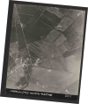
Dr. Ritchie's findings called for
further investigation into the case
of the “Lost Aerial Photos of
Arnhem". |
|
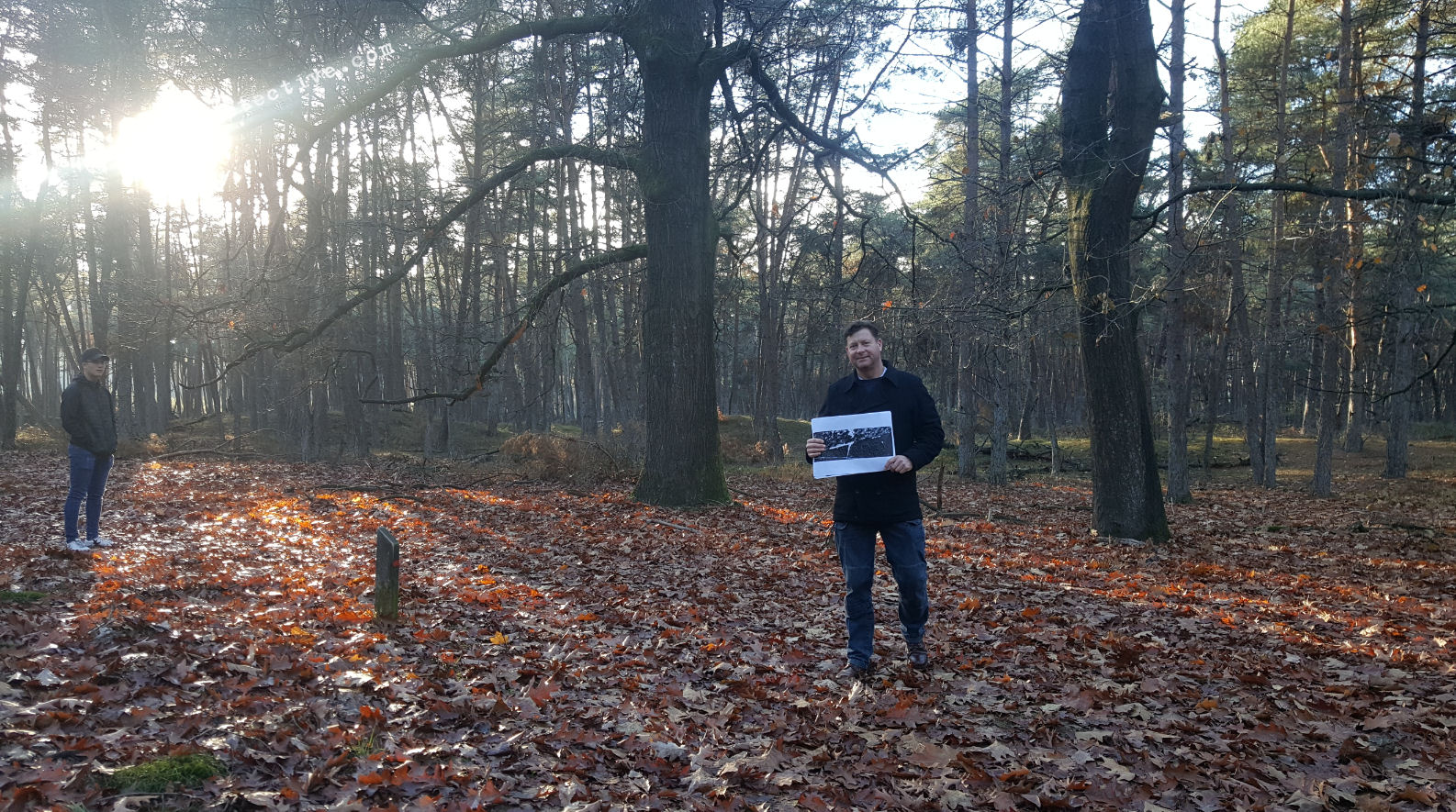
SYNOPSIS: |
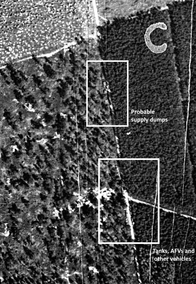
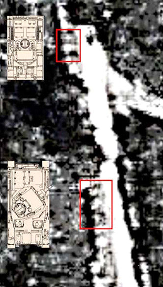
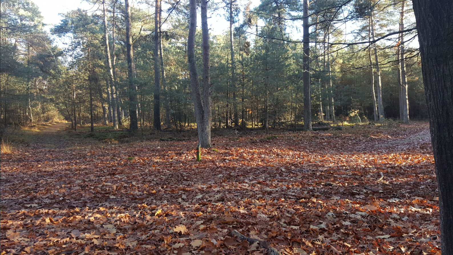
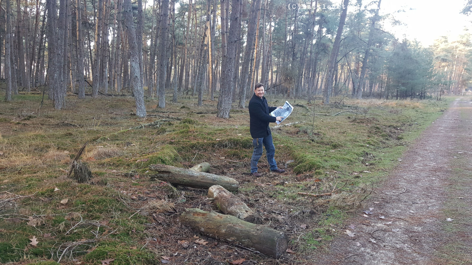
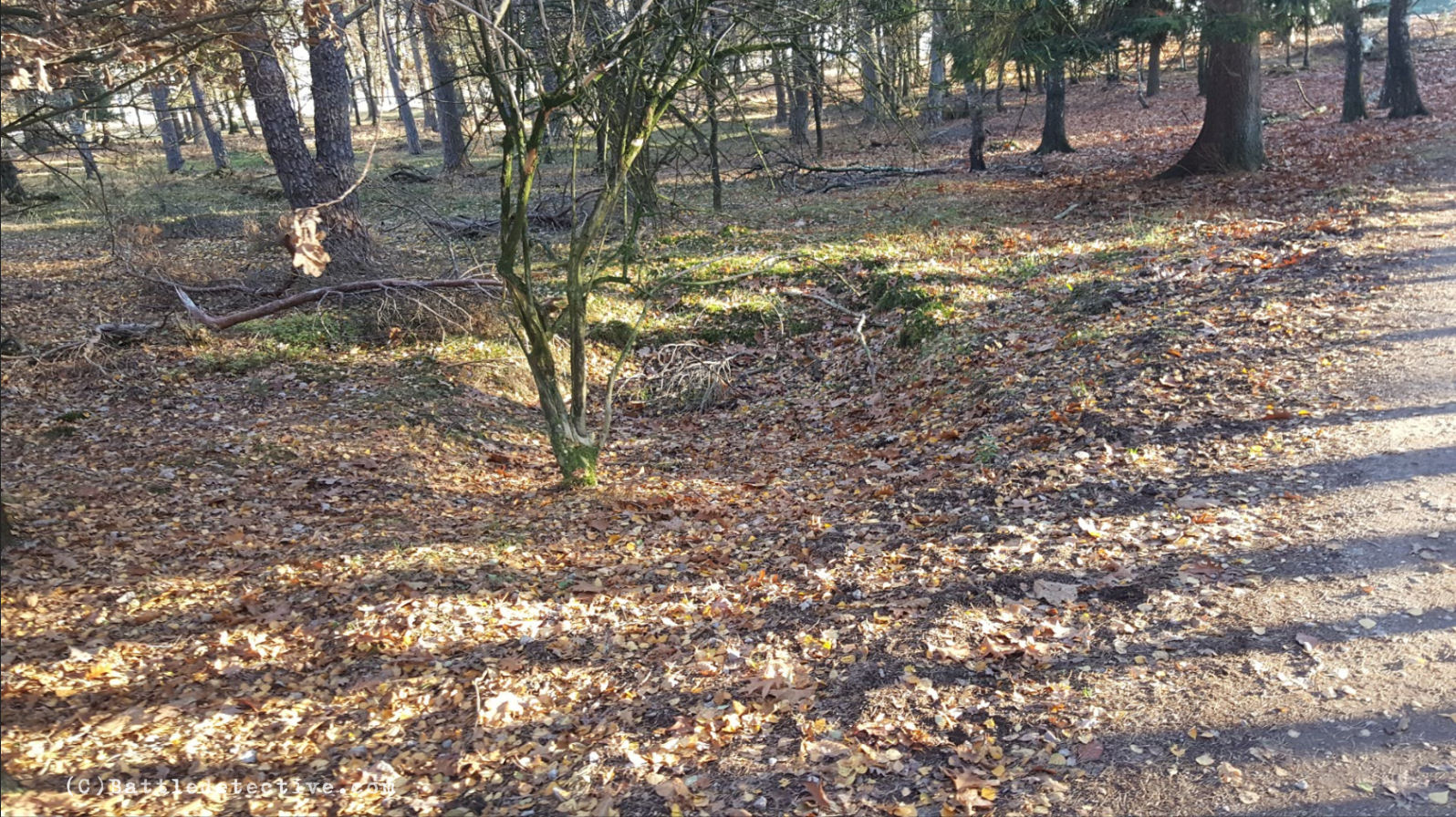
Observation of the T-junction in
Deelerwoud Forest
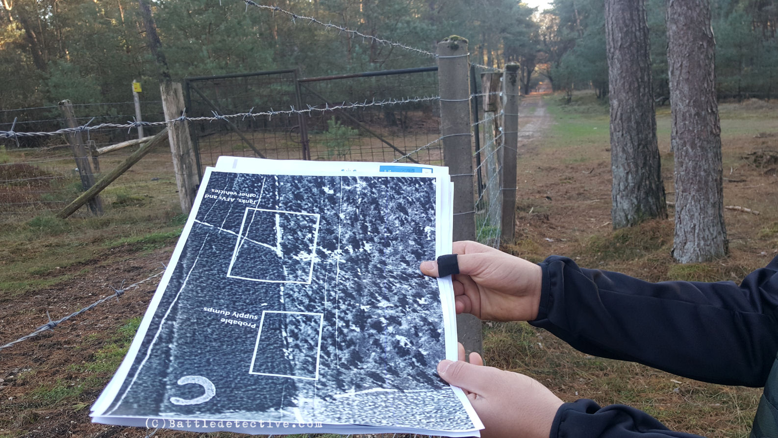
On Sunday 18NOV2018 Battle
Detectives proceeded to the areas
indicated in Ritchie’s analysis as
“Probable supply dumps” and “Tanks,
AFVs and other vehicles” on frame
4015. We found these locations by
comparing the terrain features in
frame 4015 with satellite images on
Google Maps and pinpointed the
GPS-coordinates. These areas are
located along an unpaved track named
Hoge Delenseweg in a wooded area
named Deelerwoud (Forest of Deelen)
which can only be accessed on foot.
We found the T-junction with the
supposed vehicles and a gate at the
end of
the track close to where the supply
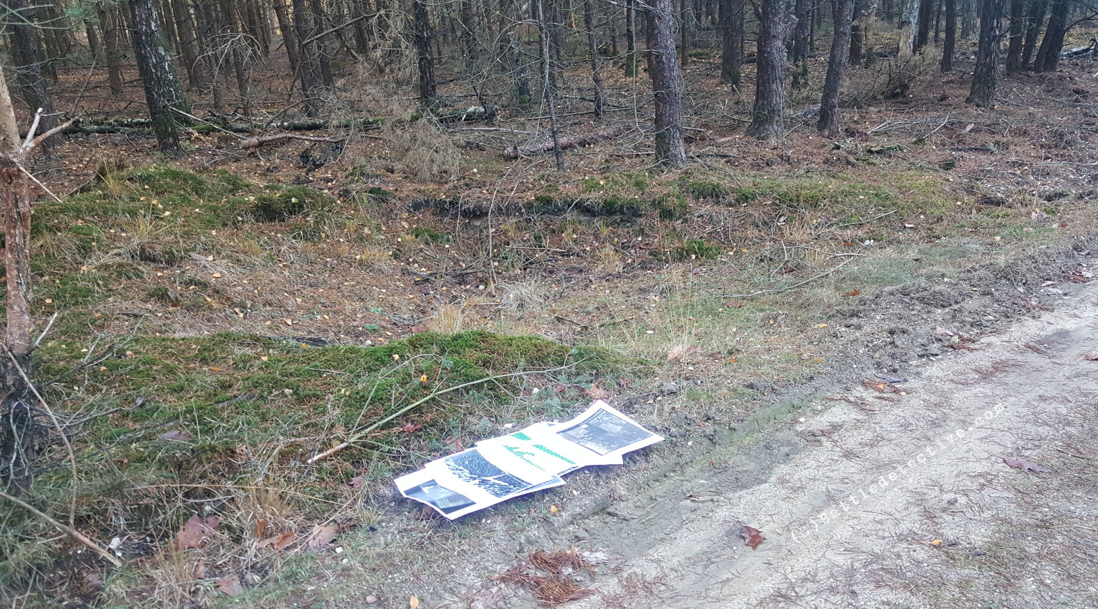
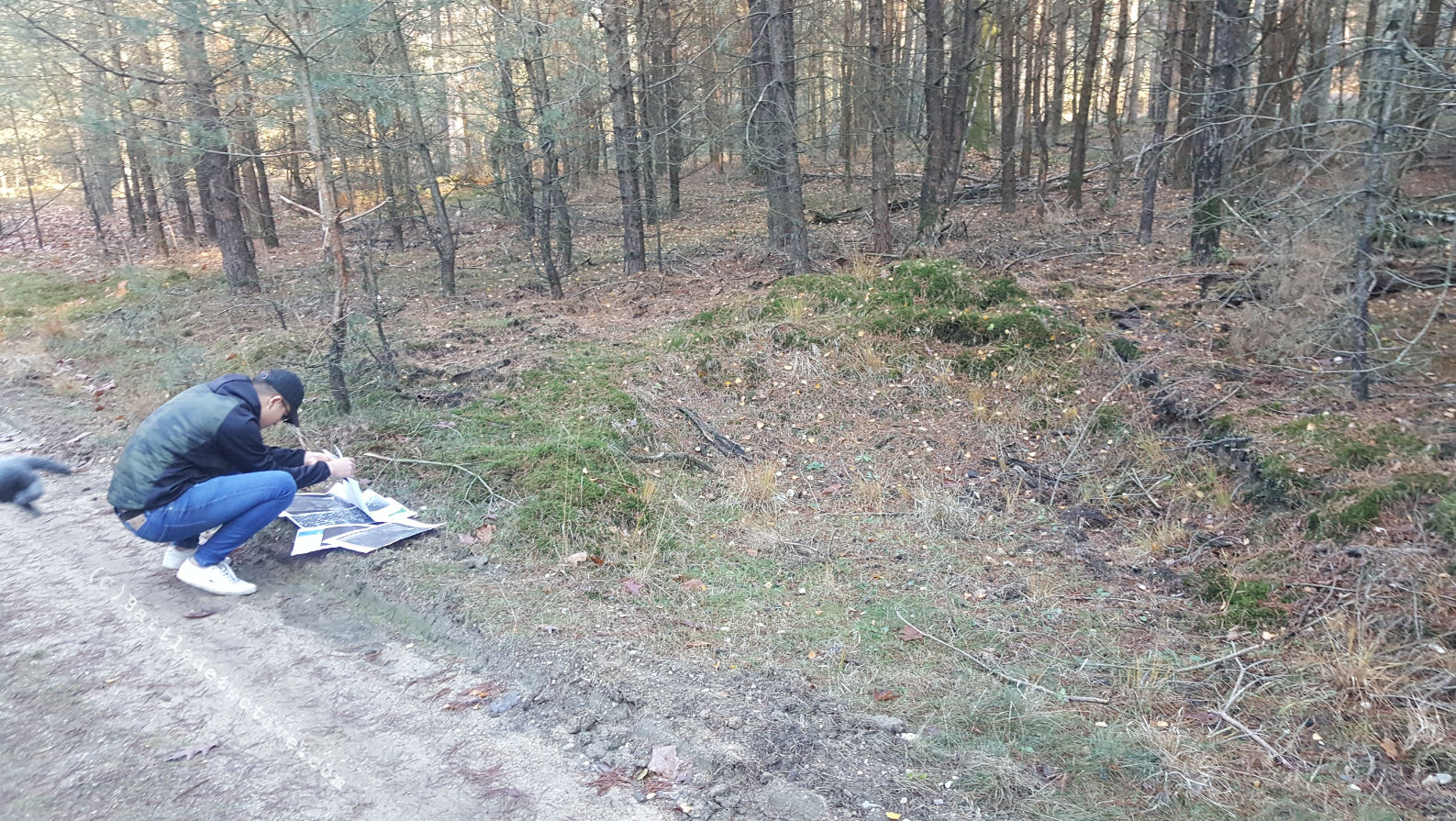
dump would have been. Other than a
significant number of large
rectangular shaped pits, placed
diagonally in the verges of the dirt
track, we found no man-made
structures in close proximity
of the forest path. For some time it
was theorized that these holes had
been constructed to park AFV's in
during bivouac. |
|
(click to enlarge)
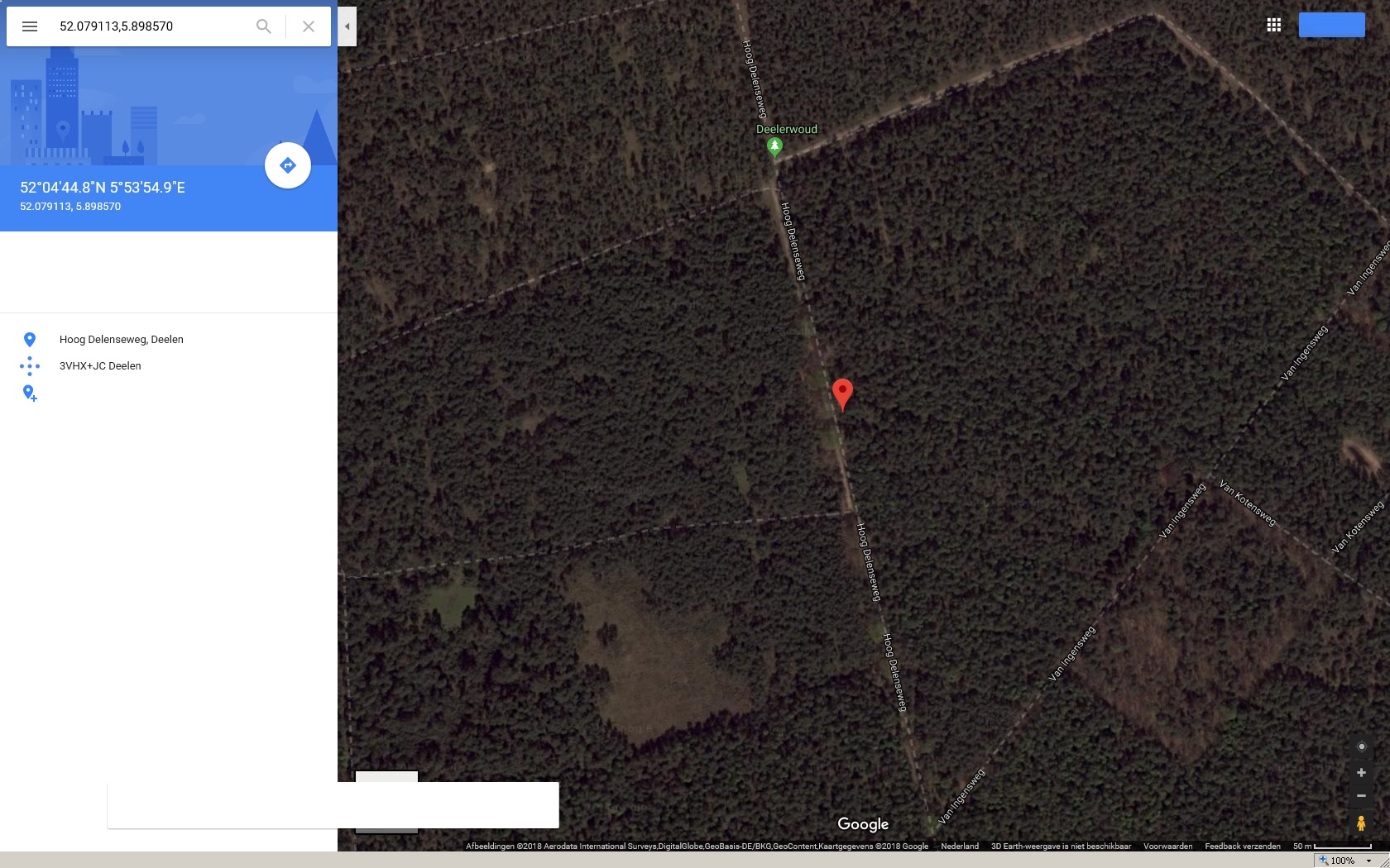
Fig. 1
The current position of the
T-junction in Deelerwoud.

The T-Junction on
Hoge Delenseweg,
the gate at the north end of the
track looking south,
and the airspace above area "C"

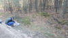
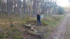
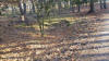
The partially
overgrown man-made dug-outs along
Hoge Delenseweg in the Deelerwoud
Forest |
An enquiry made via e-mail on
19NOV2018 with the proprietor of the
forest, the "Vereniging
Natuurmonumenten", revealed that "the
way you have described, these are
waterholes. These are drainage spots
to allow rain water to run from the
road top. This has happened often in
the past and these are maintained as
well."
|
Discoveries made at Wageningen
University
The discoveries of this agency made
on Wednesday 21NOV2018 in the
Special Collections Library of
Wageningen University & Research are
amazing and prove Dr. Sebastian
Ritchie’s thesis wrong.
Apparently Ritchie has only accessed
the photos he used, online and
ordered a high-resolution copy of
frame 4015 which was the only one
with markings on them.
It is our theory that Ritchie has
been looking for photographs taken
of the area around Arnhem taken
during photo reconnaissance missions
shortly before Operation Market
Garden.
He thus found the series taken on
12SEP1944 and zoomed in
on the photo with the markings on
it.
His theory is that the letters A, B,
D, and F indicated areas with no
enemy activity and C did have enemy
activity. Ritchie then sees tanks in
such detail that he can make out
older Panzer III types and by
deduction the Hermann Goering
Parachute Panzer Training and
replacement Regiment which saw
action on 17SEP1944 in Son and later
in Nijmegen. |
|
(click to enlarge)
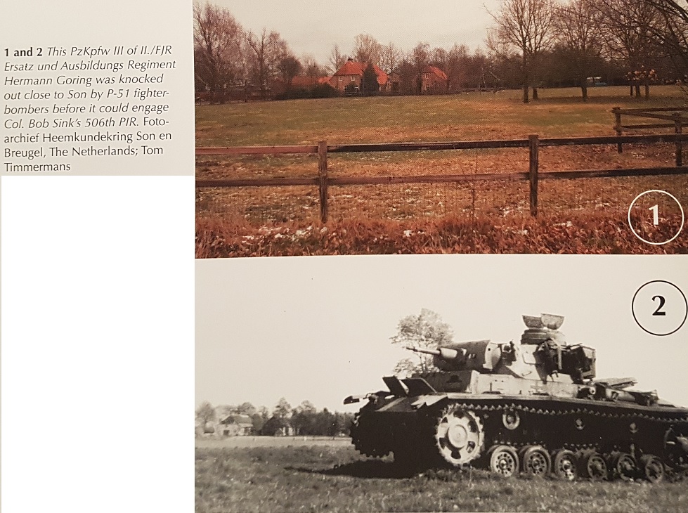
Fig. 2
Now & Then comparison of the
location where one of the
PzKpfw III of II./FJR Ersatz und
Ausbildungs Regiment Hermann Göring
was knocked on 17SEP1944 in Son in
the book "Operation
Market Garden"
(ISBN-13: 978-1-61200-586-7) by
Simon Forty and Battle Detective
Tom |
Backside of photo
However, in the Wageningen
University & Research collection of
World War 2 Royal Air Force photos
we took a look at the backside of
the print of frame 4015 and found
that these markings were made for
the 1949 Dutch publication of the
“Boor & Spade” (Drill and Spade)
periodical about soil and ground
mapping.
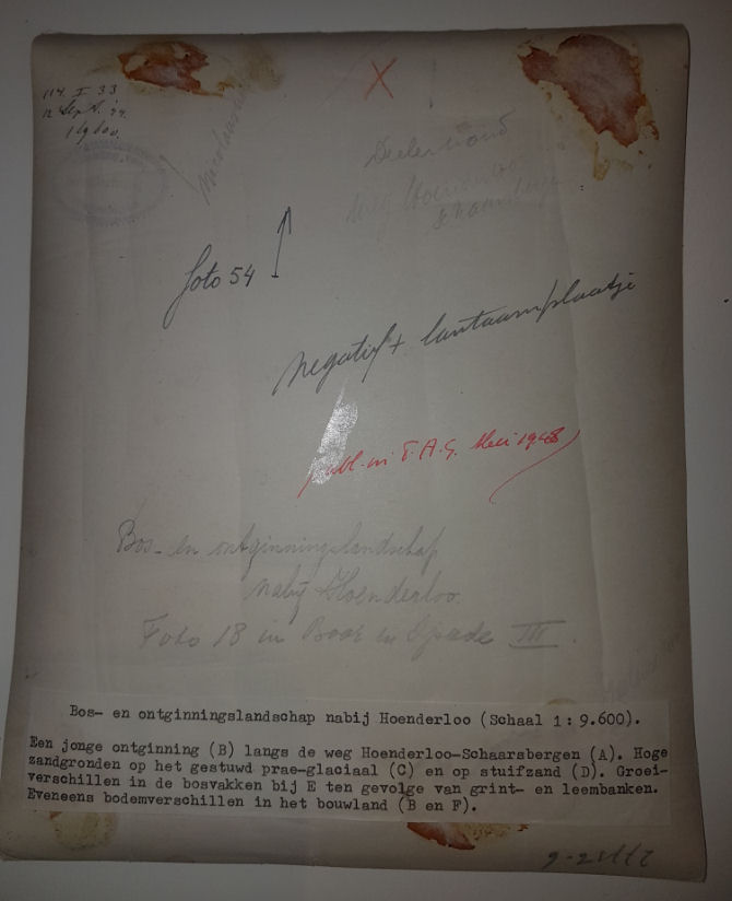
Frame 4015 is used as photo 18 in
this issue and shows (as can also be
seen in the English summary: "High
sandy soils on the Veluwe to the
north of Arnhem. A road. F young
arable land. C wood. D
shifting sand with heath.
B and E differences in growth in the
wood owing to gravel-pans and
loam-pans." |
|
(click to enlarge)
Special
Collections on Wageningen University
Campus
and the backside of photo 4015 |
The Original Dutch caption for
section "C" is "High sandy land on
stowed pre-glacial" but not: "enemy
activity".
The markings have been added in
1949, not in 1944 and for the
purpose of illustrating various
types of soil in the Veluwe area in
"Boor & Spade". |
|
(click
to enlarge)
"Don't judge a
book by its cover"
The 1949 issue of
"Boor & Spade" and the use of frame
4015
as an illustration of various types
of soil in the Arnhem area |
|
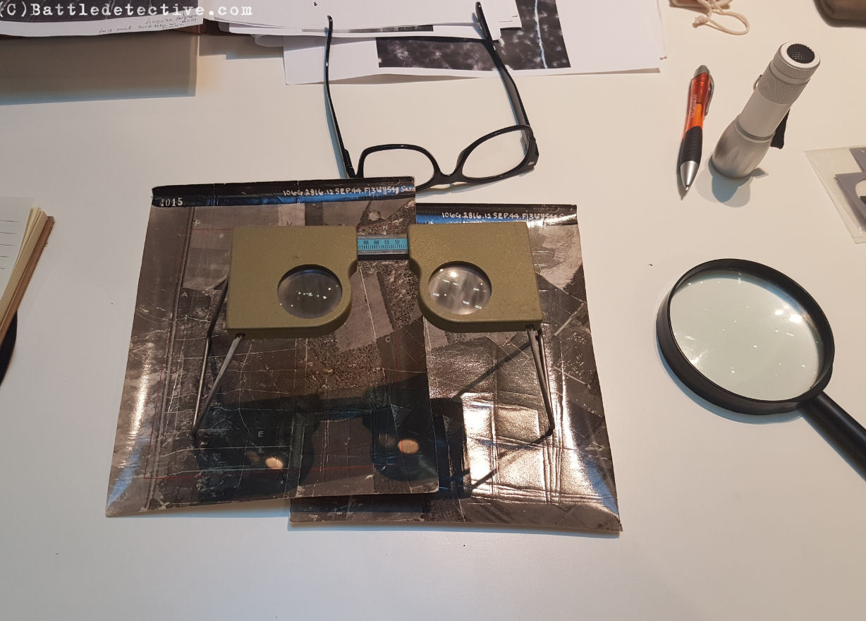
We also found that by looking at
both frames 4014 and 4015 through
our stereoscope, using +1 reading
glasses
and a strong pocket lamp shining on
it, we could create a 3D-image of
the area.
We were able to make out objects on
the T-junction which we visited on
18NOV2018, but found it impossible
to tell if we were looking at either
wooden crates or vehicles.
We did observe, however, that the objects in
the photo taken on 12 (and on 19;
more later)
SEP1944 are not in place at
present. |
Anaglyph 3D-image of the objects
on T-junction
We created a stereoscopic red
and cyan image of one of the photos
we took of the print, showing the
objects on the T-junction. There are
clearly man-made objects with a
certain height placed along the
forest path. It is not possible to
ascertain if these objects are
wooden crates, stacks of wooden logs
or soft-skinned or armored
vehicles though. |
|
(click to enlarge; 3D
red-cyan glasses are recommended to
view this image correctly)
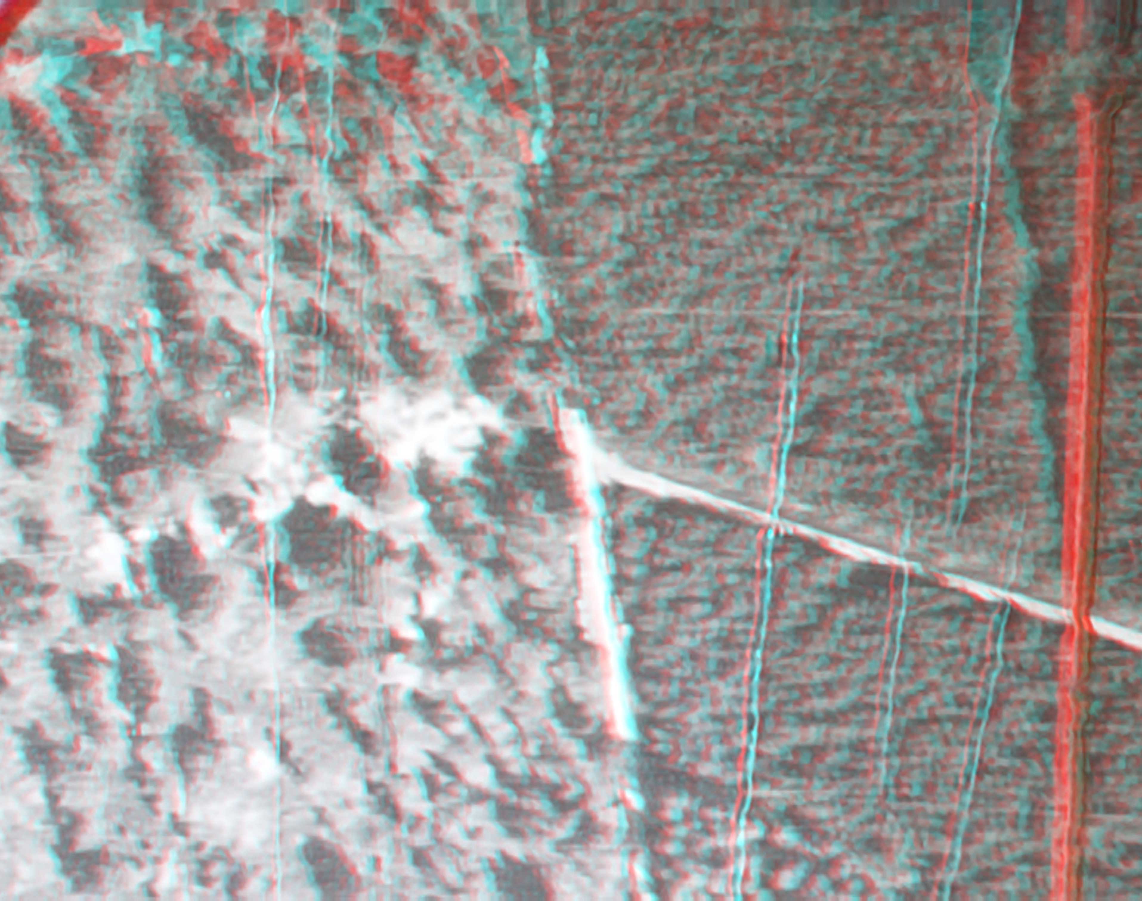
Anaglyph of the T-Junction with
objects clearly present.
Are we looking at crates, piles of
lumber, soft-skinned vehicles or
tanks? |
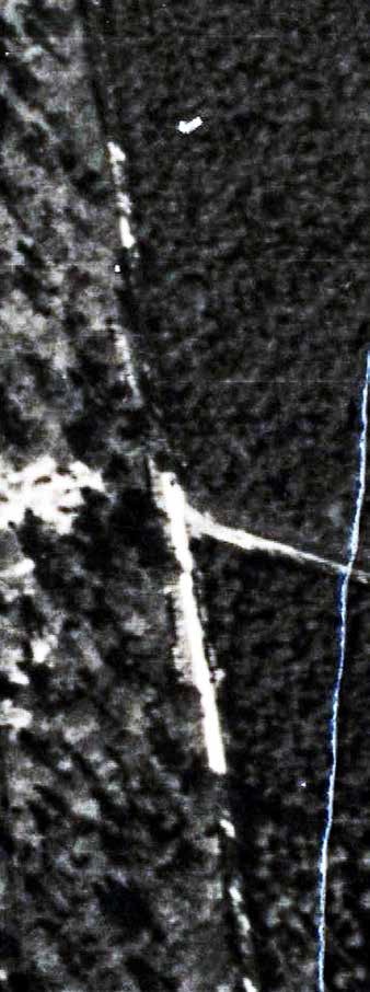
Imagery Interpretation
On page 40 of Dr. Ritchie's "Arnhem,
The Air Reconnaissance Story" we
read:
"It was a high-altitude sortie
that located armour north of Arnhem
on 12 September 1944, including
Panzer IIIs
and IVs ‘tucked in underneath
woods’. However, they belonged not
to II SS Panzer Corps, but to the
Hermann Goering Parachute Panzer
Training and Replacement Regiment, a
formation that had long been using
the same
area for training, as the Allies
well knew. A key component within
this narrative was the order issued
to the
Hermann Goering Regiment on the
previous day, dispatching them to
Eindhoven. When they were caught on
camera, they were arming, refuelling
and moving
south in preparation for this
deployment. It was probably
reasonable to identify the tanks as
a potential threat
to 1st Airborne Division but the
issue was not straightforward. The
appearance of modern tanks such as
Panthers or Tigers in the imagery
would certainly have provided
grounds for serious concern, but the
prevalence
of older model Panzer IIIs and IVs
could well have suggested to an
experienced
intelligence officer that they
belonged to a second-line unit of
questionable combat capability.
A reasonable conclusion might have
been that the photograph reinforced
the broader intelligence picture of
German militarisation in the Market
Garden area but did not necessarily
point to a specific threat from a
first-line
panzer formation at Arnhem." |
Dr. Ritchie suggests here that the
type of AFV can be discerned from
the photo and that from it, the unit
can be deduced and that these
vehicles were moments away from
deployment elsewhere.
The Wageningen University librarian helped us and found
that another photo reconnaissance
sortie was flown on 19SEP1944; two days into
Operation “Market Garden”.
Sadly just the prints of two frames,
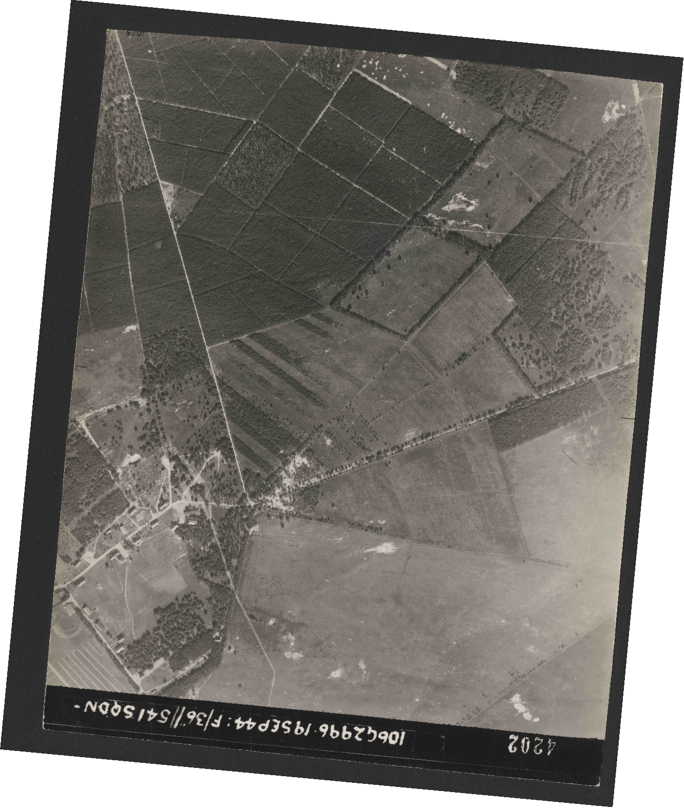
numbers 4201 and
4202 in the series of this sortie,
which show the T-junction in the Deelerwoud Forrest, are missing.
The librarian did show us the high
resolution scan of these frames on
her computer screen. In our
perception these images showed the
same objects along the T-junction
and the "Supply Dump objects" a bit
further north sitting
on the dirt track, as can be seen on
the photos of 12SEP1944.
If these were working AFV’s they
would have been deployed.
Therefore, if these were the Panzer
III’s of the Parachute Panzer Training
and Replacement Regiment Hermann
Göring they would
not have been at the T-junction on
19SEP1944.
|
In the following comparison we see
the image used in Dr. Ritchie's
hypothesis about the objects seen on
12SEP1944 being tanks that were
deployed south of this location on
17SEP1944, at left. At right we see
the same location on 19SEP1944; two
days into Operation "Market Garden".
Both images show the high-resolution
digital
scans of the photos on the
librarian’s computer screen and
enlarged to the biggest possible
size without the pixilation
rendering it unsuitable.
|
|
(click
to enlarge)
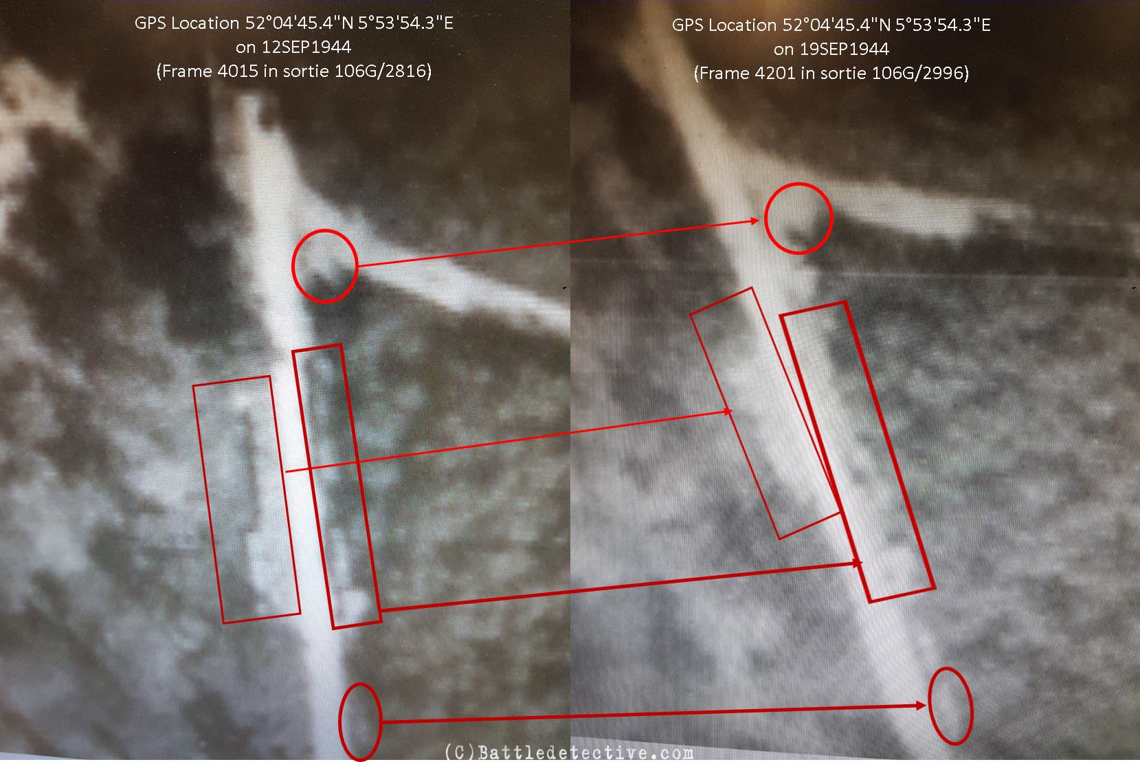
Fig. 3
comparison of the T-junction on 12
and 19SEP1944 from the digital scans |
Hypothesis
There are also photos taken on the
22FEB1945 and on these, the supply
dump objects are now not on the
track anymore but next to it in the
woods. It seems that the objects
next to the T-junction are gone on
that day.
Therefore it can be concluded that
Dr. Ritchie was drawn to Section C
in the aerial photo with the objects
because
of the markings on the photo print
of which he erroneously assumed that
these were made by a photo
intelligence analyst.
He saw armored fighting vehicles (AFV's) in some shapes on the
photo of which he assumed that these
AFV's belonged to the Parachute Panzer Training and
Replacement Regiment Hermann
Göring.
This unit saw action on the 17th but
the aerial photos of the 19th show
the same objects still in place.
It is therefore highly unlikely
that photo 4015 shows German armored
fighting vehicles which were
deployed during Operation Market
Garden.
|
Validation the hypothesis
From our findings in Wageningen
University and in Deelerwoud we have
developed the hypothesis: "Frame
4015 of RAF sortie 106G/2816 of
12SEP1944 and frame 4201 of RAF
sortie 106G/2996 of 19SEP1944
both show the same objects on
the T-junction in the Deelerwoud and
are most likely not German
tactical vehicles as theorized
by the Royal Air Force Air
Historical Branch (RAF AHB)".
To validate this hypothesis it is
imperative to test its
falsifiability.
Below are five statements and their
argumentations as contrary views on our
hypothesis, which are in turn
answered by our validating
observations.
|
Falsifying statement 1: The book
where the lettering was found is not
available in the UK.
A further difficulty arose
because most of the interpretation
reports that went with the
photographs have been destroyed. The
lettering was discussed with several
members of the Medmenham
Association, which specialises in
the history and heritage of air
reconnaissance, and they all assumed
that it was written on during the
analysis/interpretation of the photo
in September 1944. It will obviously
be necessary to amend the Arnhem air
reconnaissance study to take account
of the discovery in the Special
Collections at Wageningen
University.
Validating observation
This statement confirms that an
assumption was made about the
lettering on the print of frame 4015
which started the focus in this
photo and subsequently the rest of
the RAF AHB's theory which was
solely based on a digital scan. |
Falsifying statement 2: Frame
4015 of 12SEP1944 wasn't the only
instance in which the objects on the
T-junction in Deelerwoud were
photographed and recognized prior to
the operation.
An RAF Mosquito also photographed
our area of interest on 12 SEP1944.
In this instance, the mapping
created by the Allied Central
Interpretation Unit has survived in
the UK, and an 'A' has been marked
on frame 4023 at the precise
location where the tanks were
photographed. This letter would have
been matched to another 'A' written
onto the photograph itselx`1f (or a
blow-up of part of the photograph),
and stapled to a single page
interpretation report. As an example
of this procedure, see the photo of
the V2 launcher on page 14.
Therefore, we can be 100% certain
that this specific place was of
significant interest to the Allies.
In addition (on page 22), it is
recorded in the UK National Archives
that a Form White (a fast,
high-priority interpretation report)
was generated following the Spitfire
sortie on 12SEP1944, and that the
Deelen area was the subject of this
report.
Validating observation
On the illustration on page 24 we
see a section of map G.S.G.S. 2541
N. of Arnhem (Holland). The map
supposedly shows what the cameras in
the Mosquito sortie have
photographed and on it several
rectangles have been drawn. One of
these rectangles has the number 4023
written in it and it covers the
Deelerwoud. There is no other
marking inside this rectangle; let
alone a letter ‘A’. On page 23 we
read however: "A plot supplied by
the National Collection of Aerial
Photographs records the track flown
over Deelen by the Mosquito, and
shows that its cameras were
activated directly over the woods
where the German armored unit had
previously been spotted. The
plotters at the Allied Central
Interpretation Unit, RAF Medmenham,
had also marked this area with an
‘A’". An image of the marking of
this area with an 'A' by the Medmenham plotters
was NOT provided. This only proves that
another sortie was flown over the Deelerwoud on 12SEP1944. It is very
likely that this plot and said 'A'
marking is not available today. The
photograph on page 14 is merely an
illustration of what a letter 'A'
written on an aerial photograph
looks like. The
hypothesis "There is supposedly a
letter 'A' on a photo taken in the
area of the Deelen Luftwaffe base,
hence it must refer to objects on a
dirt track north of this base" isn't
a logical one.
There is no doubt at all that the
Deelen area was an area of great
interest to the Allies as this was
the location of Fliegerhorst Deelen;
a large German Luftwaffe air force
base which could pose a great threat
to Operation "Market Garden" in the
form of enemy fighter planes and
anti-aircraft artillery.
|
Falsifying statement 3: Two
highly qualified RAF intelligence
analysts provided their input on the
theory about German tanks.
Their view was that the 12SEP1944
and the 19SEP1944 photos only appear
similar at low resolution. At high
resolution, it is clear that the
12SEP1944 photo is far more
three-dimensional, showing objects
on the ground that project up
towards the camera. These are
rectangular, suggesting vehicles,
and the sun reflection off at least
four turrets is the classic
indicator of armoured vehicles. They
appear as 'pin-heads'.
Validating observation
We have looked at both prints of the
frames taken of the T-junction in
Deelerwoud (frames 4014 and 4015) in
person. We used a stereoscope and
could not discern detailed features
on the square shaped objects sitting
along the T-junction; let alone
identify Panzer III's, their 75 or
37 mm guns in turrets pointing in
various directions, or
self-propelled guns and halftracks.
Our method was the (3rd) next best
thing after (1st) having either
irrefutable evidence of presence of
these vehicles there and then, or
(2nd) access to the negatives of the
photographs. For "Arnhem" the RAF AHB made use of digital scans
ordered from the prints kept at
Wageningen through the Dotkadata
company which is the next (4th)
optional method in a descending
scale of suitable means of analysis.
Ordering of the RAF photos is
through this
website and it lists the highest
resolution as: gem. (average)
9500x11000 pixels.
|
|
(click to enlarge)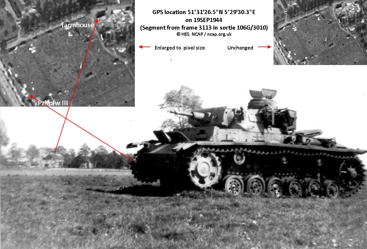
Fig. 4
What an object known to be a
Panzerkampfwagen III looks like
in a close up photo and on an aerial
reconnaissance photograph
(frame 3113 from sortie 106G/3010;
NCAP-000-000-039-722,
Wolfswinkel; North Brabant; The
Netherlands
Copyright HES, nacp.org.uk) |
|
The diagram in
Fig. 4 shows proof of the
presence of a Panzerkampfwagen III
in a meadow alongside the road to
Arnhem at Wolfswinkel North of Son (first
in the scale of evidential value).
The AFV sat there from 17 SEP1944
onwards as it was destroyed by
Allied fighter planes on that day.
The insets are sections of a digital
scan of an aerial
reconnaissance photo taken on
19SEP1944 showing the meadow with
the AFV in it (fourth on the
evidence scale).
The vehicle appears as a white
rectangle and without the knowledge
from the close up we might as well
be looking at a discarded
refrigerator. |
Falsifying statement 4: The
German vehicles seen on 12SEP1944
are gone in the 19SEP1944 photo.
By contrast, the 19SEP1944
photo is one-dimensional: there are
no vehicles there. You are looking
at the ground. When armoured
vehicles – especially tracked
vehicles – park anywhere, they scar
the ground, turning it into bare
earth or mud. The parking areas in
this photo had probably been used
many times over by vehicles using
the supply dumps (which are visible
on both dates), so the ground would
have been heavily scarred. These
scarred areas are completely
different in appearance from the
equivalent – occupied – areas in the
12SEP1944 photo (see for example
page 20).
Validating observation
Look at the comparison in
Fig. 3. The difference
between both images is that the
19SEP1944 photo is less focused but
not that it would lack a dimension.
The falsification theory has it that
19SEP1944 photo shows the traces of
(the tracks on) the vehicles shown
on the 12SEP1944 photo.
We have been in Deelerwoud in
November 2018. We observed that the
T-junction is in a narrow dirt road
and that the soil in the woods is
sandy and dark of color when wet or
moist. This was the weather at the
Royal Netherlands Meteorological
Institute at De Bilt (approximately
50 kilometers from Deelerwoud) in
September 1944:
|
|
(click to enlarge)
 |
These data paint a picture of a
rather rainy start of the month with
chilly temperatures causing a moist
if not wet forest floor with a dry
top layer. The latter is why the
dirt track in the Deelerwoud stands
out in the woods like a bright line.
The difference in color of the
objects along this track, between
the photos taken on 12 and 19SEP1944
is minimal at best and not such that
it warrants the assumption that we
are looking at vehicles first and
at their marks in the ground a week
later.
Vehicle tracks in soil this moist,
would leave dark trails. Moreover,
the (new) theory ("the rectangular
shapes in the 19SEP1944 photo are
the imprints in the soil of tanks on
those same spots as in the 12SEP1944
photo") is highly implausible. A
tracked fighting vehicle that drove
away from its parking spot does NOT
leave behind a contour of its shape
on the ground; unless it had sunken
hull-deep into the ground. When tracked vehicles
move on unpaved soft terrain, they
tend to leave behind trails that show up as
a double line on aerial photos, like
this:
|
|
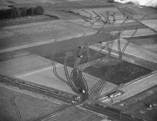
American tanks of the 2nd Armored
Division move through soft terrain in
Germany, 1945
(C) George Silk—The LIFE Picture
Collection |
It is therefore that we consider it
most likely that in both the 12 and
19 SEP1944 photos we are looking at
the same objects. It is a misfortune
that the prints of the images taken
on 19SEP1944 are missing from the
Special Collections in Wageningen
University as a stereoscope
comparison might reveal more
knowledge on what is or isn't to be
seen on the images.
|
Falsifying statement 5: The
enhanced photo of 12SEP1944 shows
objects that can be recognized as
tanks.
In the detailed blow-up on page
38 of the RAF AHB publication, one
can clearly see the turrets of both
tanks, the frontal armor and cupola
of the Panzer IV, and the gun and
rear hatch hinges of the Panzer III.
The two RAF analysts were 'very
happy' with these identifications
and with the 'certain’ ,'probable' and ‘possible' labels that were
used. One cannot deny that these are
tanks of the type identified by
Brian Urquhart (and Tony Hibbert);
tanks of exactly the type that later
showed up at Son. In addition, there
is no mention of the fact that the
12 SEP1944 photo shows tactical
objects moving along the road, both
in the wood and slightly to the
north (see page 21). Again, these
objects are entirely absent from the
19SEP1944 imagery.
Validating observation
When attaching so much value on the
input of these analysts it is
important to determine when the
moment was that they were happy with
the labels ‘certain’, ‘probable’ and
‘possible’. How were they asked to
comment on these labels? Was this
after the labels had been added to
the image or were they asked to look
at the junction without any prior
knowledge?
On page 38 are two enlarged sections
of frame 4015 captioned “Digital
enlargement and enhancement of Frame
4015, 106G/2816, 12 september 1944”.
This is the illustration on the
right, undoubtedly the 'enhanced'
image:
|
|
(click to enlarge)
 |
Here, the digital image has been
enlarged beyond the level of the
pixels in the resolution as provided
(9500x11000 pixels) and the images
starts showing horizontal and
vertical lines that are newly
added by the software. Look for a
reference at the tree tops in the
forest; the whole image looks as if
covered by a checkered layer. The
enlargement is too large for this
resolution because the image gets
distorted/warped/mutilated; in other
words altered. It is in this
enhancement that the RAF AHB
historian
recognized 'pinheads' or turrets and
gun barrels whereas in fact he saw
horizontal and vertical lines that
were most likely added by the
algorithm of a noise reduction
software program which uses an overcomplete DCT dictionary (as
opposed to - for example- globally trained
dictionaries). This type of software denoises digital images by replacing
pixels with filters from its own
collection in the way that it is
programmed. The image on page 38 is
in all probability an enlargement of
the scanned aerial photo after this type of denoising
because the "grid" on it is
consistent with the horizontal and
vertical lines in the filters of
such a dictionary.
|
|
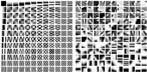
Left: An
overcomplete DCT dictionary; right:
a globally trained dictionary
Source: "Hierarchical Matching
Pursuit for Image Classification:
Architecture and Fast Algorithms",
www.researchgate.net |
In reference to the tactical
objects, or more specific the German
tanks of the Herman Göring
Fallschirmjäger Ausbildings- und
Ersatz Regiment we note that on page
17, Dr. Ritchie is less sure: on the
one hand he claims that they are
armored fighting vehicles, on the
other he concedes that they are
'impossible to identify'. Focusing
on these objects (if these are
moving can't of course be
discerned from a photograph) is also
rather superfluous as it was only
because of the 1949 annotations on
the print that Dr. Ritchie's
interest was drawn to this image. We
might as well analyze any other
object in the image.
|
|
The above validation proves that
imagery analysis is not an exact
science (yet) and is often a matter
of interpretation. Any input on our
hypothesis is appreciated by this
agency. |
CONCLUSION:
This isn't a review of the RAF AHB
publication; Dr. Sebastian Ritchie's
work is much appreciated and he has
undoubtedly put much time and effort
in it and provides insights on aerial
photo reconnaissance and image
interpretation. Our investigation
only provides the evidence that
labeling frames 4014 and 4015 taken
on 12 September 1944 as the photos
that show German armor near Arnhem
prior to Operation "Market Garden"
is based on an incorrect assumption
upon which subsequently a
significant part of the RAF AHB's
publication is based.
The search for the lost aerial
photos of Arnhem is therefore back
to the starting point.
|
|
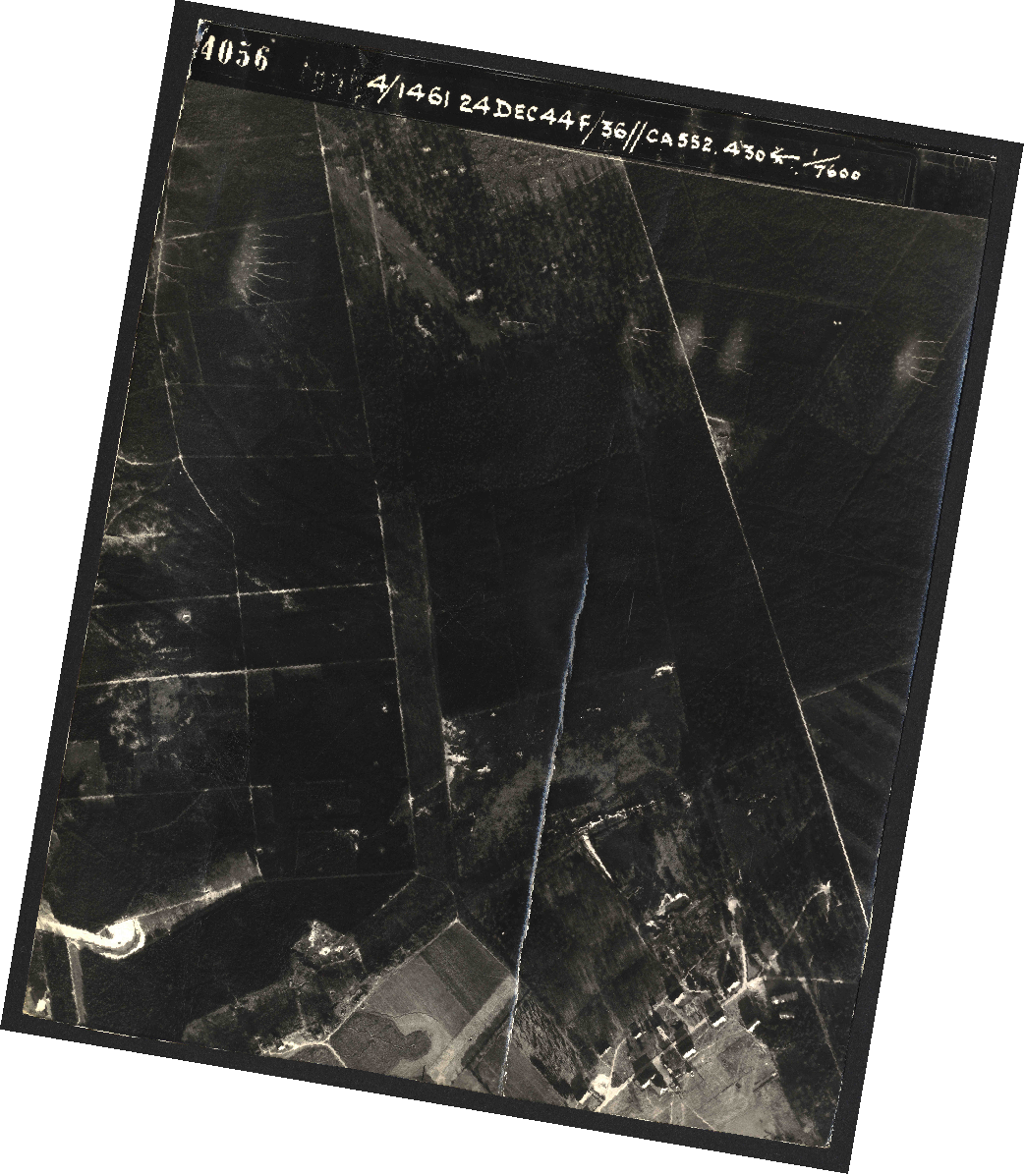
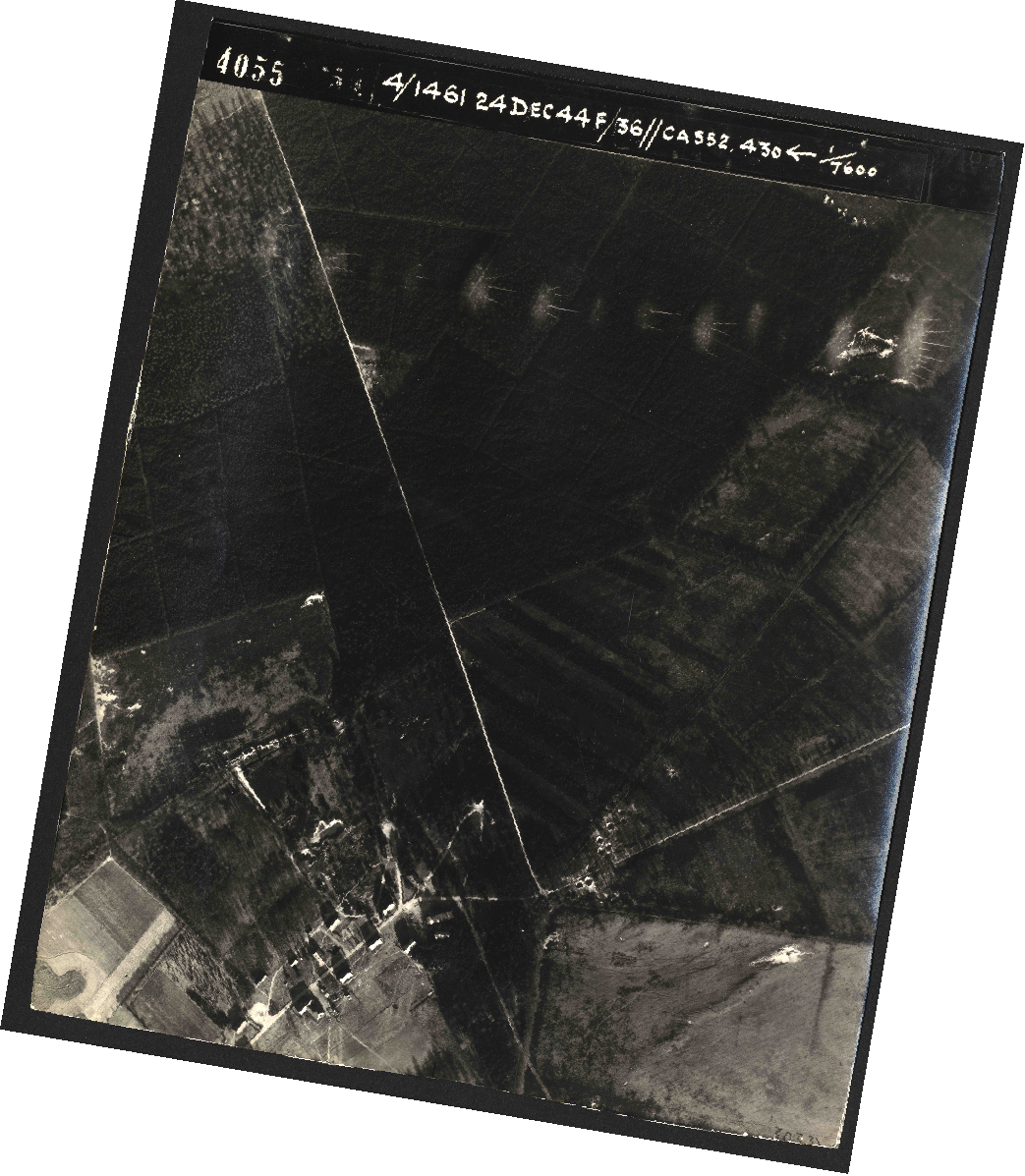
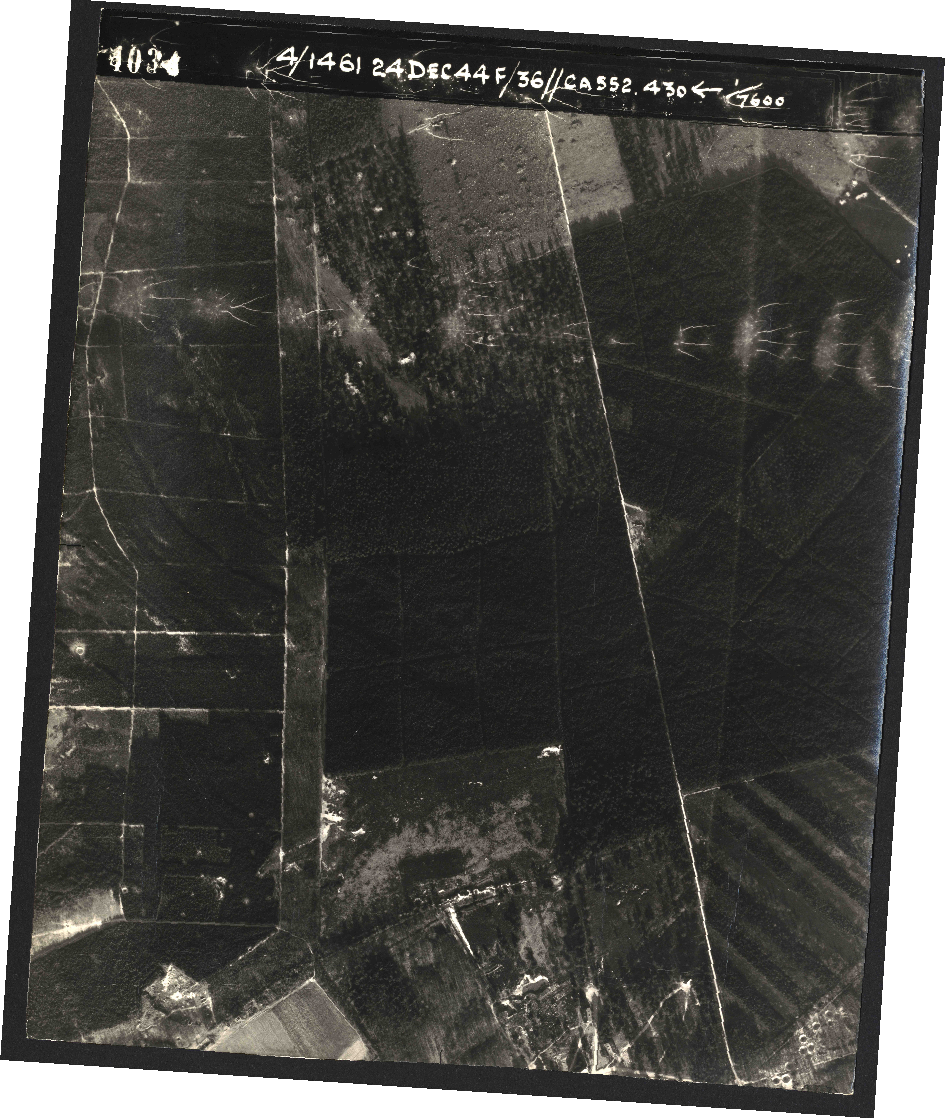
EXHIBITS:
All ten (10) aerial photos in the
Royal Air Force collection at
Wageningen University & Research
showing the T-junction in Deelerwoud
Forest, taken in 1944 and 1945. |
|
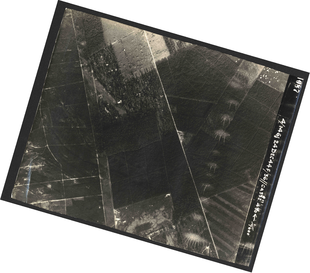
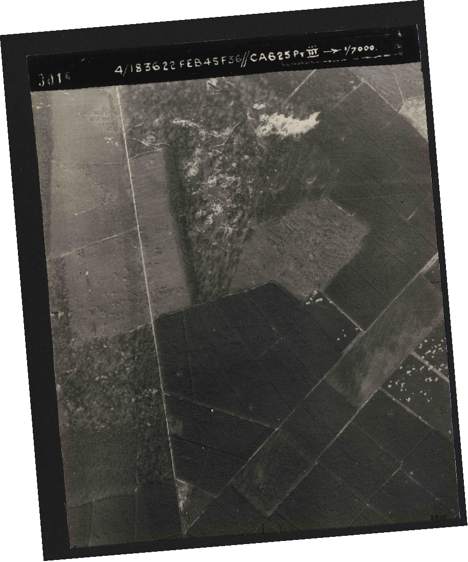
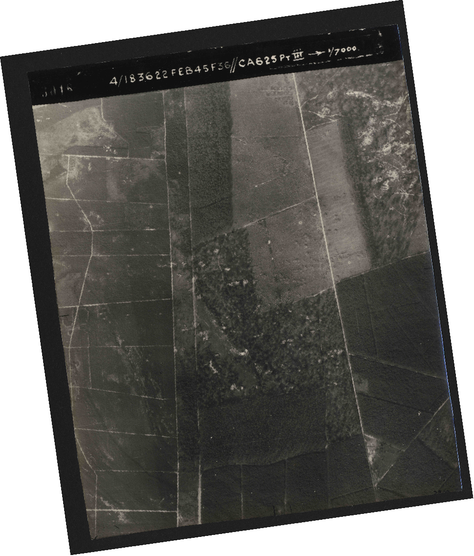
(Click to enlarge)
12SEP1944
19SEP1944
24DEC1944
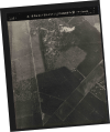 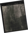
22FEB1945 |
UPDATE 20FEB2020:
On the website of the Royal Air
Force we found a
new version of Dr. Ritchie's
publication "Arnhem the Air
Reconnaissance Story" dated
March 2019.
The discovery of the post-war
addition of the letters on the
aerial photo is only briefly
mentioned as:
"At first, this was assumed to be
wartime lettering relating to an
interpretation report, and this
proved to be one of the most ironic
features of the Arnhem air
reconnaissance story. In fact, the
lettering on the photograph was
added by Dutch cartographers after
the war. Historical attention was
thereby attracted to the right
photograph but for the wrong reasons."
And in the Conclusion chapter of the
publication we read:
"Two photographs from 106G/2816 –
frames 4014 and 4015 – were found to
have covered this area, and frame
4015 had been marked with several
letters. Naturally, therefore, it
was assumed that they
referred to objects of military
significance described in an
interpretation report, and this
supposition was reinforced by the
views of several members of the RAF
intelligence community, both serving
and retired. In fact, the
lettering had been added after the
war."
Significantly more effort was made
in explaining Ritchie’s assumption
of what the rectangular objects in
frame 4015 of sortie 106G/2816 taken
on 12SEP1944 could have been. Or
rather "should be" as Ritchie
continued in his Conclusion:
"Nevertheless, by an
extraordinary coincidence, a
high-resolution copy of frame 4015
revealed a large column of military
vehicles, including armoured
vehicles, either parked by or moving
along the track through the
Deelerwoud, and the larger
rectangular objects believed to be
supply dumps.
[…]
The most obvious approach
available to study the appearance of
the tanks involved digital
enlargement and enhancement of the
imagery to the maximum extent,
accepting some pixelation."
And with this acceptance, the
distortion of the original imagery
by the over complete DCT dictionary
of the software that was used is
ignored only to justify the
observation:
"However, at least four
turrets are visible, and vertical
frontal armour can be seen in at
least three cases."
Page after page are then filled
describing the objects Ritchie sees
in the enlarged pixels.
Some examples of Dr. Ritchie's
perceptions of the digital
'inkblots' in the images:
|
|
(Click to enlarge)
_small.jpg)
_small.jpg)
_small.jpg)
_small.jpg)
Dr. Sebastian Ritchie's Rorschach
test like responses and
interpretations
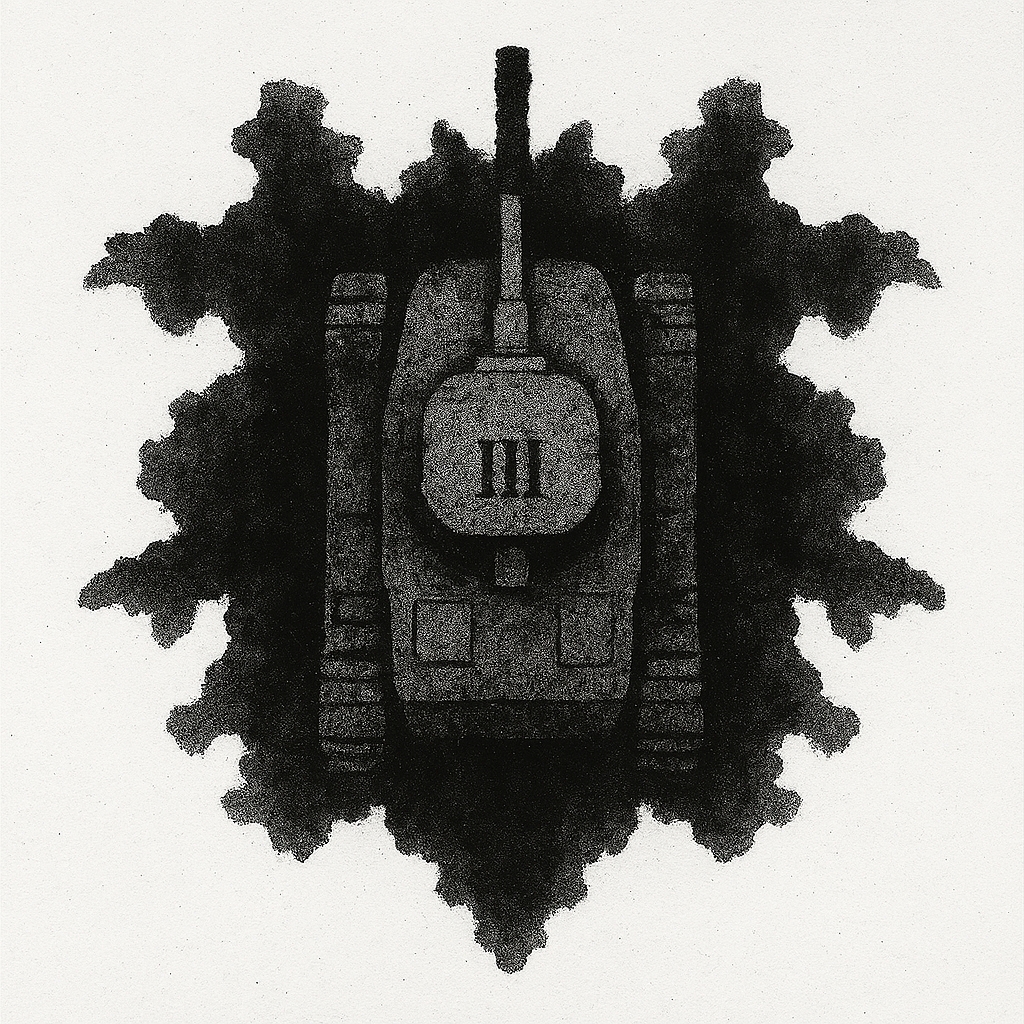
Rorschach ink blob in which one
may recognize a Panzerkampfwagen III
as well.
(Image created for this
Case File) |
In closing, the same hypothesis
about the objects of similar shaped
and size seen on frame 4015 of
sortie 106G/2816 taken on 12SEP1944
and on frame 4201 of sortie
106G/2996 taken on 19SEP1944 as
Ritchie presented to this agency in
January 2019 is repeated:
"Close analysis of
high-resolution photographs taken on
both dates fortunately settled the
issue. The objects visible along the
woodland track on 12 September were
threedimensional in character. They
clearly projected upwards towards
the camera, and the effect was
magnified by the extensive shadows
that each vehicle generated.
Numerous objects in the photograph
were also obviously symmetrical.
There were multiple straight lines,
parallel lines and right-angles. By
contrast, except where the supply
dumps are concerned, these features
were completely absent from the 19
September photos. The features
visible on the 19th are
two-dimensional and were caused by
scarring left on the ground by
parked (and often tracked) vehicles,
which presumably stopped there
regularly to rearm or refuel. No
vehicle shadows are visible on the
19th, only tree shadows, and there
are no symmetrical objects."
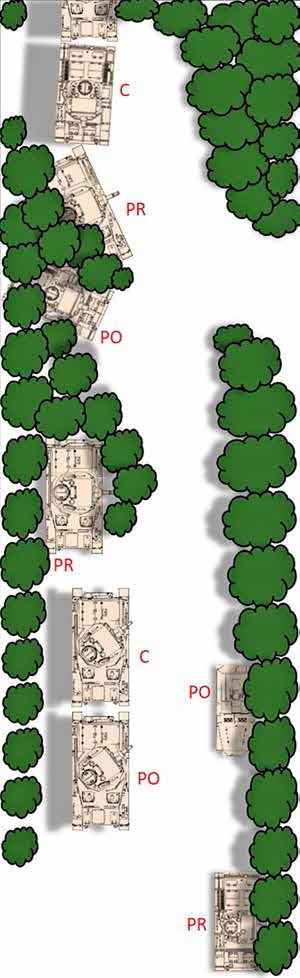
This theory is to be illustrated by
this diptych: |
|
(Click to enlarge)
 |
Hypothesis of what objects
actualy are
When looking
at the objects in Deelerwoud through
a stereoscope, the first thing that
came to mind was square boxes or
crates. The nearby Deelen air base
at that time was a sealed off "Sperrgebiet"
bustling with secreat activities
such as the storage and launching of
V-weapons and the deployment of the
fist jet fighter; the German
Messerschmitt Me 262. Also, by
12SEP1944 the airbase was being
dismantled and Luftwaffe equipment
was ready to be shipped to Germany.
This Dutch resistance had good
internal sources on the airfield and
the information was sent to London.
It is this agency's hypothesis that
the objects seen in Deelerwood on
12SEP1944 where crates with
components for the Me262, V-weapons
or other types of Luftwaffe
supplies.
|
(Click to enlarge)
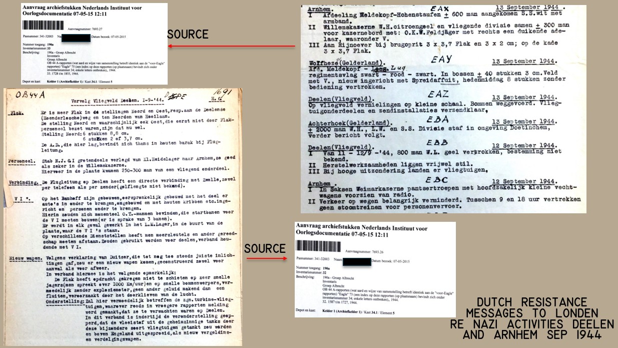
Fig.: Messages from the Dutch
resistance with intelligence on the
German military activities in Arnhem
and Luftwaffe airbase Deelen in
early SEP1944. These messages where
typed and photographed and sent to
London.
They describe a hectic
situation in Arnhem and at the
airbase.
_small.jpg)
_small.jpg)
_small.jpg)
Fig.: A V1 rocket at the Deelen
airbase museum on 20AUG2025
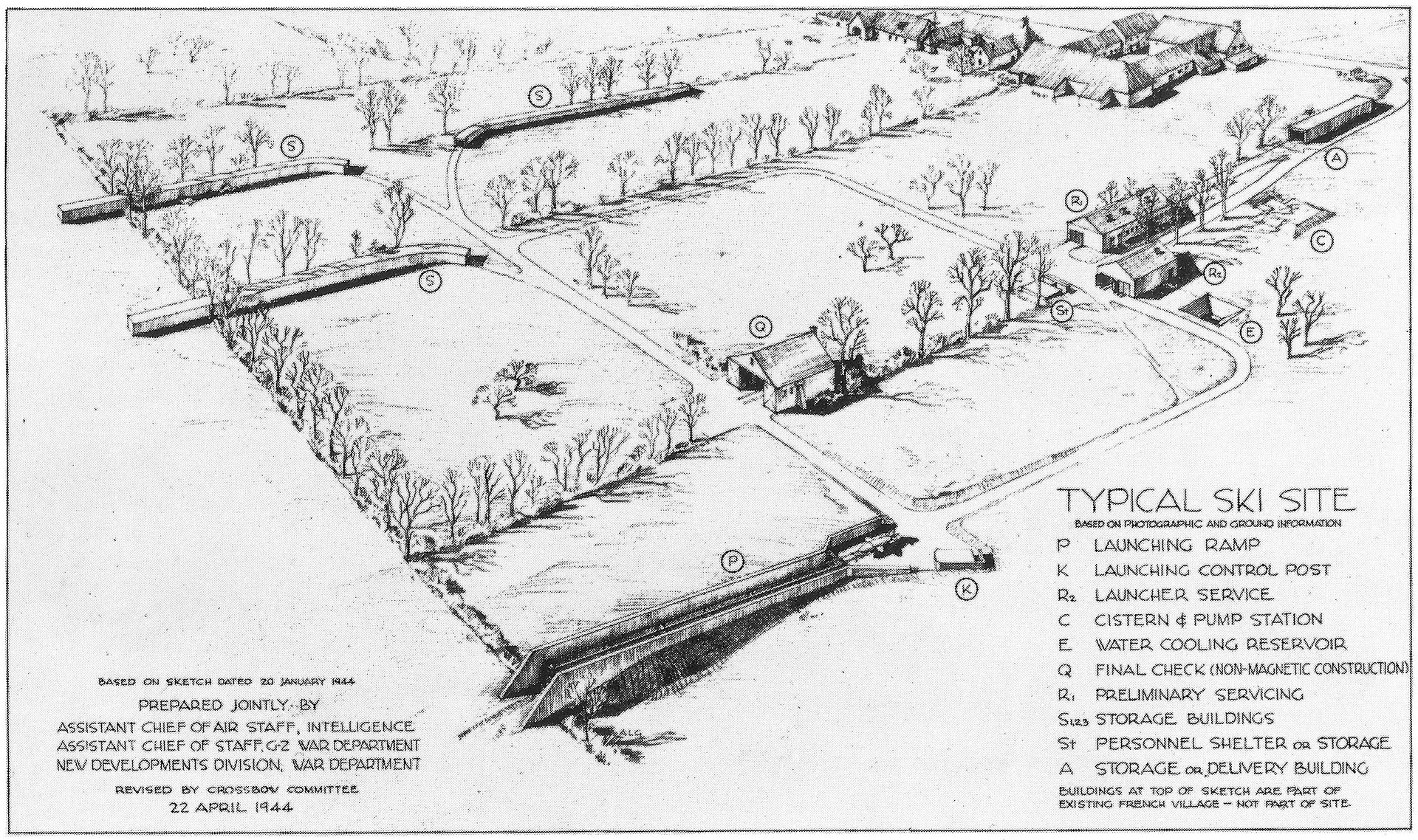
Fig.: Allied intelligence sketch
showing what a typical V1 launch
site looked like.
The storage
buildings indicated with "S" might
be what is seen
on the 12SEP1944
RAF photographs of Deelerwoud. |
CONCLUSION: Dr. Sebastian
Ritchie’s 2nd (adapted) edition
features these new elements:
1) The post-war markings (from the
1949 Boor & Spade publication) were
merely instrumental in finding the
much sought-after aerial photos of
German armor in the Arnhem area.
2) The distortions by the digital
image software after blowing the
photo up, are used to support the
claims of seeing tanks.
3) The similar objects seen 2 days
into the operation are no longer
tanks but their imprints in the
forest floor.
Behold a classic example of tunneled
vision aimed at remaining "right"
with the shared "views of several
members of the RAF intelligence
community" as the prime piece of
evidence. In our opinion the
adaptations in the original thesis
still render it insufficient to
persuade anyone of the presence of
German armor in Deelerwoud forest
prior to Operation "Market Garden".
It is likely that the objects
are crates containing supplies
related to the nearby German
Luftwaffe airbase of Deelen.
UPDATE 09JAN2021:
Unfortunately we can't ask an
important witness which aerial
photos he saw leading him to warn
British airborne commanders about
presence of German armor in the
Arnhem area, as
intelligence officer and post-war UN
diplomat Brian Urquhart passed away
on Saturday 02JAN2021. |
|
 |
|
Back to Case Files
 |


.jpg)
.jpg)
.jpg)
.jpg)
.jpg)
.jpg)